The Project Area
The project area is included in the two main territorial units of the Park, namely the Gran Sasso and the Laga Mountains.
The Gran Sasso mountain belongs to the central Apennine. Carbonate rocks are composed of rocks from different ages between the Triassic and the Miocene. According to its position and morphology, this area can be divided into two main sectors: the first one, with an east-west orientation, has an uneven morphology extending almost 40 km from the upper Vomano Valley up to the Tavo Valley. The other sector is characterized by less marked reliefs and has a north-south orientation for about 20 square kilometers, from the upper Tavo Valley up to the river Aterno-Pescara which separates it from the mountain chain of the Marrone Mount. The northern line in the central sector includes the highest summits: Corno Grande (2,912 m), Corno Piccolo (2,655 m), Mount Aquila (2,494), Mount Brancastello (2,385), Mount Prena (2,561), Mount Camicia (2,564).
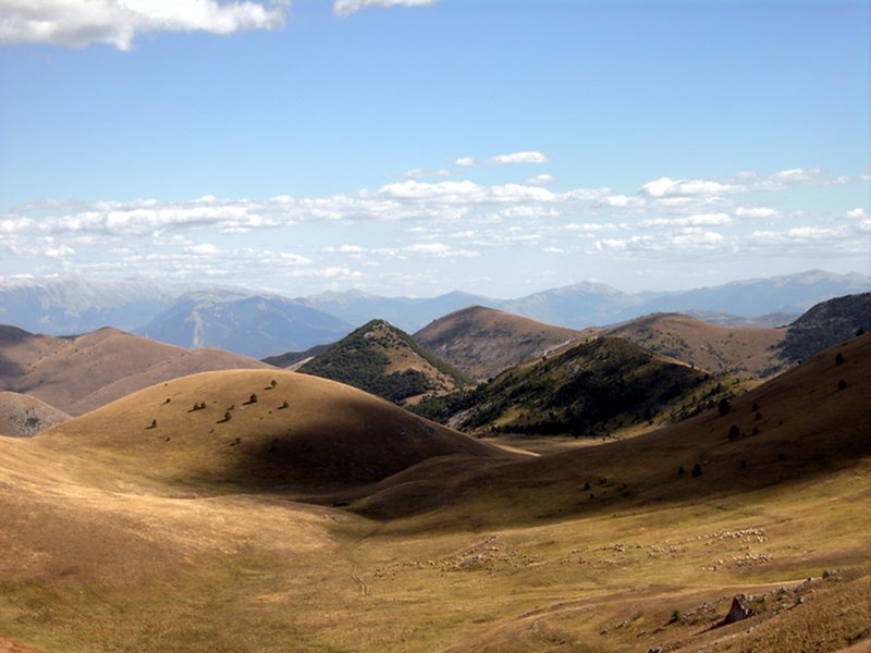
The areas situated between the mountain summits are composed of continental sedimentary depositional environments originated by the action of weather events. The most representative region is that of the wide upland Campo Imperatore (length 3 km, width 4 km). The Calderone glacier, situated on Corno Grande's northern slope, is Europe's most southern glacier, and the only one existing in the Apennines.
The west-east orientation of the main mountain chain determines a strong difference both in the temperatures and in the amount of precipitation in the two opposite slopes: the northern-eastern slope facing the Adriatic Sea is characterized by wet and warm environments, while the southern-eastern slope, where the upland of Campo Imperatore is situated, features dry environments and very cold climate conditions.
The Laga mountains represent the highest mountain chain with a siliceous lithology in the Apennines. From the Capannelle pass (1,300 m) northwards the Laga Mountains feature Mount di Mezzo (2,155 m), Mount Gorzano (2,458 m), Mount Pelone (2,259 m), Pizzo di Moscio (2,411 m), Cima Lepri (2,445 m), Pizzi di Sevo (2,419 m), Macera della Morte (2,073 m), the summit of the three borders between the Abruzzi, Lazio and the Marches. Like the Gran Sasso d'Italia the slopes have different features: the mountain side facing Lazio, Amatrice and Accumoli (RI) in particular, is characterized by cliffs and a marked gradient. The slope facing the Marches features a more rugged and uneven landscape, while that facing the Abruzzi is more wavy and gentle, even if steep slopes are present.
Up to an altitude of 1,800 m beech forests prevail, together with silver firs, yews and hollies, and with a typical undergrowth consisting of bilberry. Bilberry moorlands are typical even beyond the forest's boundaries, together with spikenard expanses, bogs, small snow valleys. A typical feature of the Laga Mountains is the presence of water on the surface thanks to a waterproof lithology: this aspect shows itself through streams, brooks and waterfalls getting over the cliffs and the steep slopes.
Grazing sheep
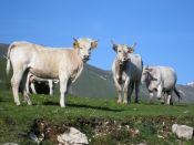
Cattle in Campo Imperatore